Hot Air - A Flight Logging and Tracking Application for Hot Air Balloon Pilots
Hot Air, developed by Gano Technologies LLC, is a comprehensive flight logging and tracking application designed exclusively for hot air balloon pilots. This app is like a logbook and data recorder in your pocket, loaded with numerous features based on pilot feedback from around the world. Hot Air has been featured twice in the Ballooning Journal, making it a reliable choice for hot air balloon pilots.
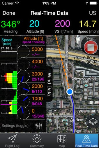
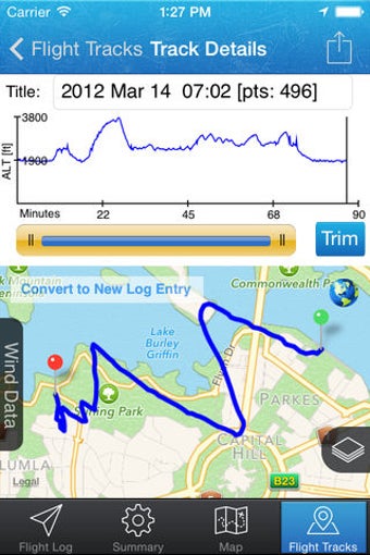
Hot Air offers real-time tracking, enabling pilots to improve their situational awareness by viewing their current location on a map or satellite imagery. It also includes waypoints to show the distance, bearing, and estimated time en route to a target location. Moreover, offline maps are available for use. Pilots can record their entire flight path, even with their screen off during recording, and export it to their computer for viewing in 3D using Google Earth. Hot Air also offers KML/KMZ overlays, allowing pilots to add custom overlay data to the real-time flight maps, such as mapping out electric lines, friendly or unfriendly places to land, denoting special airspaces, including information such as radio frequencies or phone numbers, and more.